Drone Solutions

Transforming Industries with Intelligent Aerial Technology


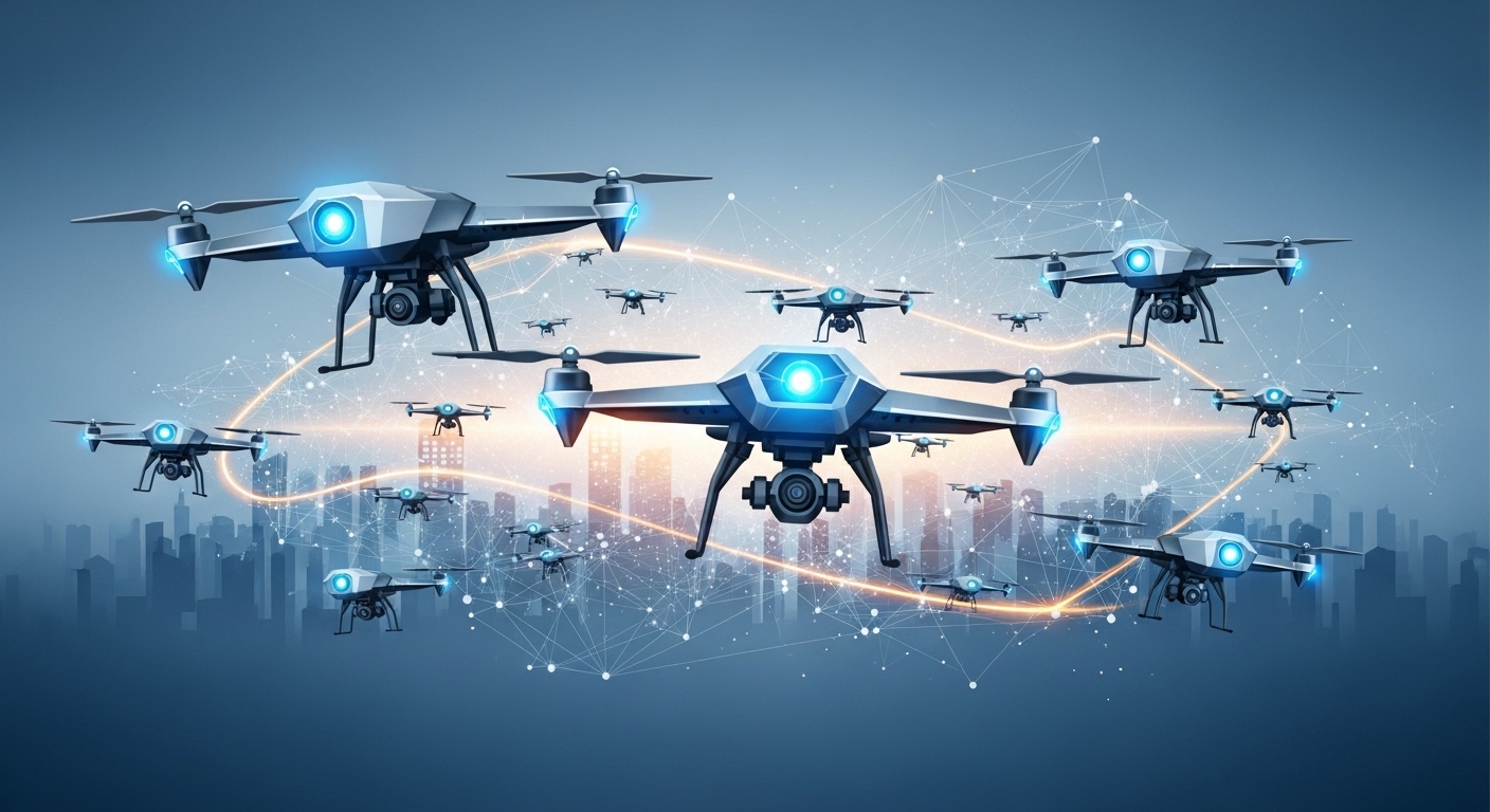
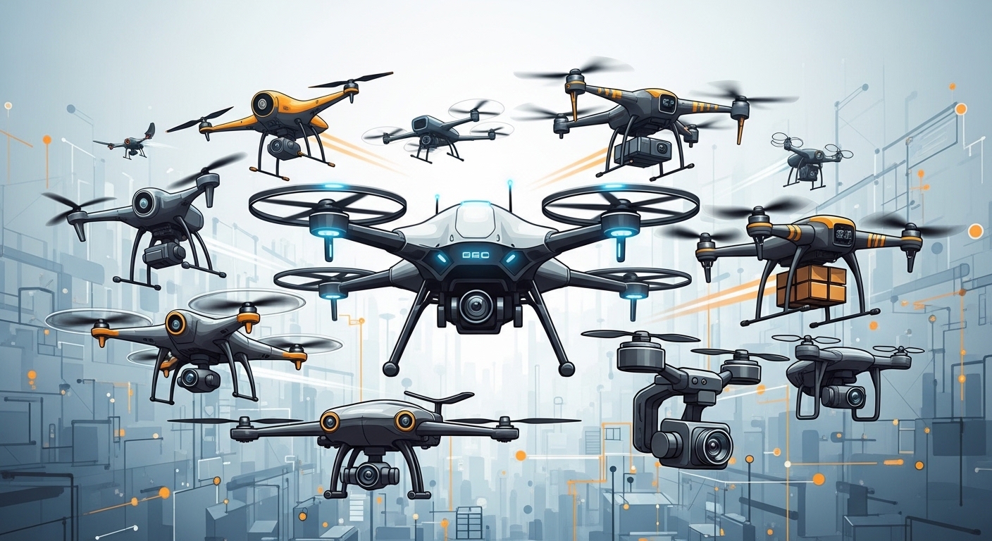
Our advanced drone solutions are designed to enhance efficiency, improve safety, and unlock new possibilities across industries. From agriculture and surveillance to logistics and defence, we provide high-performance, AI-enabled drone systems tailored to real-world challenges.

With a strong focus on innovation, automation, and sustainability, our drone technologies help businesses and government organizations streamline operations, reduce costs, and make data-driven decisions with precision.

image

Our Drone Offerings

Agriculture Drones


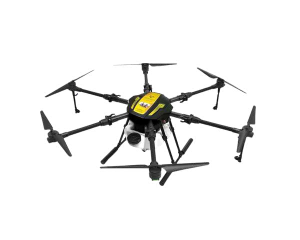
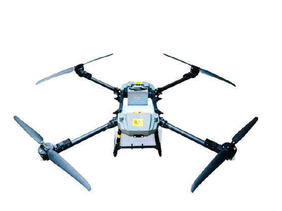
Revolutionize modern farming with precision-driven aerial solutions. Our agriculture drones support crop monitoring, spraying, mapping, and data analytics to maximize yield and reduce resource wastage.


Key Capabilities

  • Crop health monitoring & analysis
  • Precision spraying & fertilization
  • Soil mapping & irrigation planning
  • Yield prediction & farm analytics
  • Livestock and greenhouse monitoring
image

Key Applications

  • Precision crop monitoring
  • Crop health assessment
  • Weed detection
  • Pest and disease management
  • Soil analysis and mapping
  • Irrigation management
  • Planting and seeding
  • Fertilizer and pesticide application
  • Yield estimation and forecasting
  • Livestock monitoring and management
  • Crop damage assessment
  • Greenhouse monitoring
  • Environmental impact studies
  • Forestry and plantation management
  • Agricultural research and development

Key Features

  • Battery Capacity
    22,000 mAh
  • Charging Time
    25 30 Min
  • Spraying Capacity
    8 Acers per Hour
  • Flight Time
    Up to 15 Min
  • Live Video Streaming
    2MP FPV Camera
  • Radar
    Obstacle & Terrain Radar
  • Flying Range
    Up to 3Km
  • Capacity
    10L & 15L


Surveillance Drones


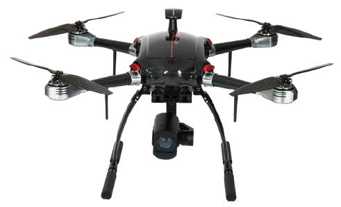
Enable real-time monitoring and enhanced security with intelligent surveillance systems. Built for reliability and accuracy, these drones provide actionable insights in critical environments.


Key Capabilities

  • Live video streaming & high-resolution imaging
  • AI-powered tracking and detection
  • Crowd, traffic & infrastructure monitoring
  • Disaster response & search operations
  • Border and perimeter security
image

Key Applications

  • Border patrol and security
  • Public safety and law enforcement
  • Disaster response and recovery
  • Crowd monitoring and management
  • Traffic monitoring and management
  • Critical infrastructure surveillance
  • Anti-terrorism and counter-surveillance
  • Environmental monitoring and protection
  • Search and rescue operations
  • Wildfire monitoring and prevention
  • Coast guard and maritime surveillance
  • Event security and crowd control
  • Monitoring of restricted areas
  • Wildlife conservation and anti-poaching
  • Emergency medical response and coordination

Key Features

  • High-Resolution Image
    4K Resolution (3840*2160)
  • Three-Way Binocular Vision Obstacle Avoidance
  • Video Transmission Range
    15 km to 150 km


Delivery Drones


Optimize logistics with fast, secure, and contactless delivery solutions. Designed for both urban and remote areas, these drones ensure efficient last-mile connectivity.


Key Capabilities

  • Parcel and e-commerce delivery
  • Medical and emergency supply transport
  • Real-time tracking and verification
  • Remote area accessibility
  • Low-cost, eco-friendly logistics
image

Key Applications

  • E-commerce package delivery
  • Medical supply and vaccine delivery
  • Food delivery services
  • Postal and mail distribution
  • Retail inventory replenishment
  • Emergency response and rescue
  • Same-day delivery services
  • Last-mile logistics optimization
  • Drone-based courier services
  • Industrial equipment delivery
  • Parcel tracking and verification
  • Remote area access for deliveries
  • Contactless delivery services
  • Small and lightweight cargo transport
  • Urban air mobility for goods

Key Features

  • Maximum Wind Resistance
    16 m/s
  • Operating Temperature
    20°C to 45°C
  • Flight Time
    30–160 minutes
  • Maximum flight altitude
    6,000 m
  • Radar
    Obstacle & Terrain Radar
  • Flying Range
    15–80 km
  • Capacity
    up to 30KG


Anti-Drone Systems


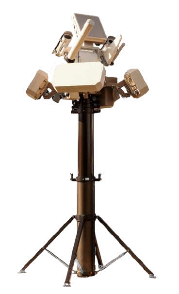
Protect critical infrastructure and airspace with advanced counter-drone technologies. Our systems detect, track, and neutralize unauthorized drones in real time.


Key Capabilities

  • Drone detection and identification
  • Signal jamming and disruption
  • AI-based threat tracking
  • Integration with security systems
  • Protection for airports, events & sensitive zones
image

Key Applications

  • Drone detection and identification
  • Jamming drone communication signals
  • GPS spoofing to disrupt navigation
  • Physical drone interception and capture
  • Drone countermeasure in critical areas
  • Protection of military installations
  • Securing airports and airfields
  • Shielding government buildings and embassies
  • Protecting stadiums and public events
  • Preventing drone-based smuggling activities
  • Border security and surveillance
  • Safeguarding prisons from drone threats
  • Counteracting drone terrorism attempts
  • Anti-drone protection for infrastructure
  • Guarding sensitive industrial sites

Key Features

  • Live Integration with Existing Security Systems Streaming
  • AI-Powered Tracking
  • Long-Range Targeting
  • Weather Resistant


Taxi Drones (Urban Air Mobility)


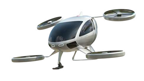
Experience the future of transportation with autonomous aerial mobility solutions. Designed for speed, safety, and sustainability, taxi drones redefine urban travel.


Key Capabilities

  • Autonomous passenger transport
  • Vertical take-off and landing (VTOL)
  • Smart navigation and route optimization
  • Eco-friendly, zero-emission travel
  • Smart city integration
image

Key Applications

  • Urban air mobility
  • Emergency medical transport
  • Disaster response and rescue
  • Tourism and sightseeing
  • VIP transportation
  • Traffic monitoring
  • Environmental monitoring
  • Aerial inspections
  • Package delivery
  • Smart city integration
  • Border surveillance
  • Event coverage
  • Rural connectivity
  • Air taxi services for corporates
  • High-risk zone transportation

Key Features

  • Maximum Wind Resistance
    16 m/s
  • Operating Temperature
    -20°C to 45°C
  • Flight Time
    30–160 minutes
  • Maximum flight altitude
    6,000 m
  • Radar
    Obstacle & Terrain Radar
  • Flying Range
    25–250 km
  • Capacity
    4 Passenger


Defence Drones


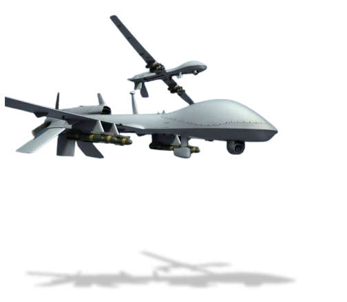
Support mission-critical operations with high-performance defence drone systems. Built for precision and durability, these drones enhance surveillance, reconnaissance, and tactical operations.


Key Capabilities

  • Intelligence gathering & reconnaissance
  • Target tracking and monitoring
  • Tactical communication support
  • Search and rescue missions
  • Border security and combat support
image

Key Applications

  • Surveillance and reconnaissance
  • Border patrol and security
  • Target identification and tracking
  • Aerial reconnaissance in conflict zones
  • Bomb detection and disposal
  • Combat operations support
  • Electronic warfare
  • Anti-drone Defence
  • Search and rescue operations
  • Tactical communication relays
  • Logistics and supply drops
  • Precision strikes and drone strikes
  • Intelligence gathering
  • Area denial operations
  • Disaster response and relief

Key Features

  • Live Integration with Existing Security Systems Streaming
  • AI-Powered Tracking
  • Long-Range Targeting
  • Weather Resistant


Drone Solutions for Disaster Management


Faster Response. Safer Rescue. Saving Lives with Aerial Technology


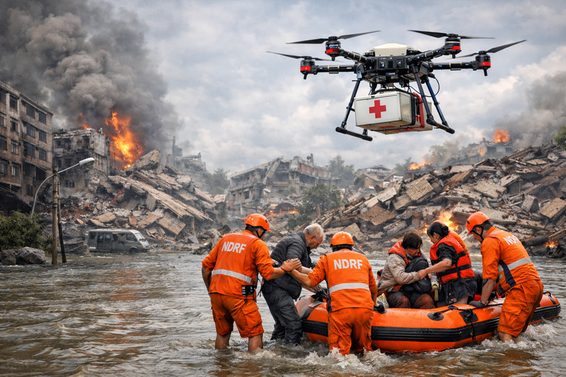
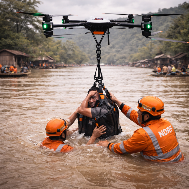
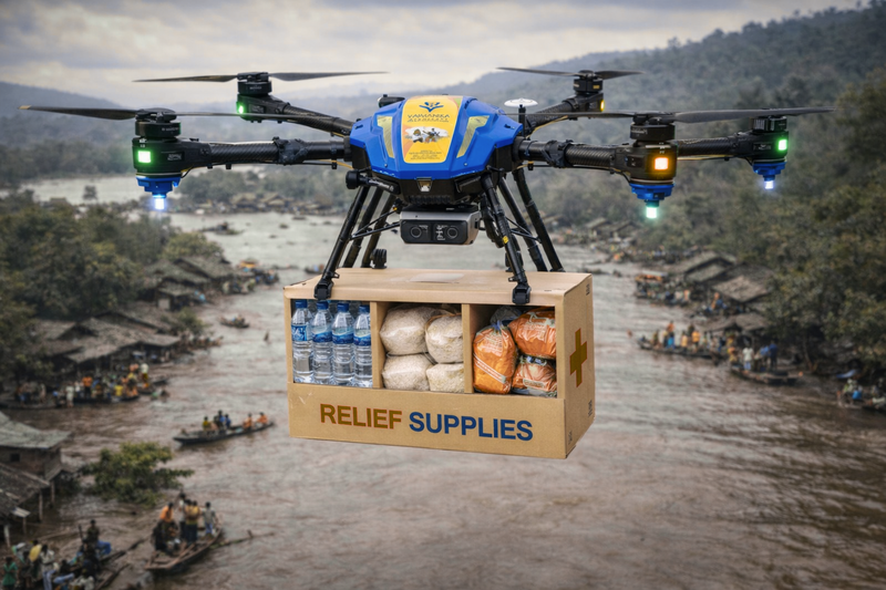
In critical situations such as floods, earthquakes, landslides, and fires, rapid response and accurate information are essential. Our drone-powered disaster management solutions are designed to support emergency teams with real-time intelligence, faster rescue operations, and safe delivery of essential supplies.

By leveraging advanced aerial systems, we enable rescue teams to operate efficiently even in inaccessible and high-risk environments.

image

Challenges During Disasters


  • Damaged or blocked roads limiting access
  • Flooded and hard-to-reach areas
  • Time-sensitive life-saving operations
  • High risk to rescue personnel
  • Limited visibility and situational awareness
image

Why Use Drones in Disaster Response?


  • Reach remote and inaccessible locations quickly
  • Cover large areas in minimal time
  • Enable real-time monitoring and decision-making
  • Deliver relief materials without risking human lives
  • Improve coordination and operational efficiency
image

Our Disaster Response Capabilities


  • Real-time aerial surveys and mapping
  • Emergency supply delivery (food, water, medicines)
  • Flood and river rescue assistance
  • Night-time search and surveillance
  • Thermal imaging for detecting survivors
image

Powering a Smarter, Safer Future


Our drone solutions are built to drive innovation, improve operational efficiency, and create sustainable impact. Whether it's optimizing farm productivity, securing critical assets, or transforming mobility, we help you stay ahead with cutting-edge aerial technology.

image

One Partner. Endless Solutions.


Whether you’re implementing AI, optimizing telecom networks, modernizing IT infrastructure, or transforming business operations — Vaanya Business Solutions is your trusted partner for innovation and growth.

Contact Us Today